Japan
World Rank: #61
377,975 km²


Next Larger Country
(Rank #60)
Zimbabwe
390,757 km²
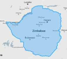
Next Smaller Country
(Rank #62)
Norway
365,268 km²


Japan: The Island Nation Larger Than Germany
Japan ranks as the 61st largest country in the world with a territory of 377,975 square kilometers (145,937 square miles). Despite being one of the world’s most technologically advanced and densely populated major nations, Japan’s true geographic size is frequently underestimated, particularly in Western perceptions where it’s often imagined as a small, crowded country of dense megacities.
What makes Japan geographically remarkable is not just its archipelago structure—comprising 6,852 islands stretching over 3,000 kilometers (1,900 miles)—but its surprisingly substantial land area. Japan is actually larger than Germany, Italy, or the United Kingdom, a fact that contradicts common misconceptions. This island nation comprises a land area equivalent to the combined size of Montana and New York state, or roughly similar to California minus San Diego County.
Located between approximately 24° and 46° North latitude, Japan experiences moderate distortion on standard Mercator projection maps. Its position on the far eastern edge of Asian-centered maps and western edge of American-centered maps means it’s often depicted smaller than its true size. This distortion, combined with Japan’s dense population centers and archipelagic layout, contributes to the widespread underestimation of its actual territorial dimensions.
Let’s explore Japan’s true size compared to other countries and regions, and what makes this island nation geographically distinctive despite its frequent size misconceptions.
Watch Japan shrink to its actual size as we move it toward the equator. We compare it to the USA, Europe, Africa, Greenland, Brazil, Australia, Russia, India, China, etc. You can use this country size comparison interactive map here.
Japan’s True Size in Global Perspective
To better understand Japan’s dimensions, direct comparisons with other countries and regions provide valuable context:

Japan vs. Eastern US: Japan would stretch from New York City to northern Florida
| Comparison | Area (km²) | Size Relative to Japan |
|---|---|---|
| Japan | 377,975 | 1.0 |
| Germany | 357,022 | 0.94 times Japan’s size |
| Italy | 301,340 | 0.80 times Japan’s size |
| United Kingdom | 242,495 | 0.64 times Japan’s size |
| Philippines | 300,000 | 0.79 times Japan’s size |
5 Surprising Japan Size Comparisons
- Japan vs. California: Japan is about 89% the size of California (423,970 km²), contrary to the common perception that Japan is much smaller.

- Japan vs. Germany and France: While larger than Germany alone, Japan would fit comfortably within the combined area of Germany and France (908,717 km²).

- Japan vs. United Kingdom: Japan is approximately 1.56 times larger than the United Kingdom (242,495 km²), despite the UK often receiving more prominence on world maps.

- Japan vs. New Zealand: Japan is about 1.4 times larger than New Zealand (268,021 km²), though both are island nations with similar volcanic and seismic activity.

- Japan vs. Australia:

Japan’s Geographic Structure: An Island Chain
Japan’s archipelago configuration creates a distinctive geographic profile:
- Island Structure: Japan consists of 6,852 islands, though the vast majority of land area and population is concentrated on the four main islands
- Main Islands: The four principal islands are Honshu (the largest at 227,960 km²), Hokkaido (83,424 km²), Kyushu (36,782 km²), and Shikoku (18,297 km²)
- Elongated Shape: The Japanese archipelago stretches approximately 3,000 kilometers (1,900 miles) from northeast to southwest, comparable to the distance from Boston to Miami
- Coastline: With 29,751 kilometers (18,486 miles) of coastline, Japan has the sixth-longest coastline in the world despite its moderate land area
- Connectivity: The main islands are now connected by bridges and tunnels, including the Seikan Tunnel between Honshu and Hokkaido, which at 53.85 kilometers (33.46 miles) is the world’s longest and deepest operational rail tunnel
Mountainous Topography: The Vertical Dimension
Perhaps the most defining characteristic of Japan’s geography is its mountainous terrain:
- Approximately 73% of Japan’s land area is mountainous, with many peaks exceeding 2,000 meters (6,562 feet)
- The iconic Mount Fuji, Japan’s highest peak, rises to 3,776 meters (12,388 feet) and is one of the country’s three sacred mountains
- The Japanese Alps in central Honshu contain multiple peaks over 3,000 meters (9,843 feet) and create a dramatic divide between eastern and western Japan
- This mountainous character leaves only about 27% of Japan’s land area available for agriculture and urban development
- The concentration of Japan’s 125 million people in the limited flat areas, particularly coastal plains, creates some of the world’s densest urban areas and contributes to the misconception that Japan itself is small
Population Distribution: Coastal Concentration
Japan’s challenging topography creates distinctive population patterns:
- With approximately 125 million residents, Japan has a high average population density of about 331 people per square kilometer
- However, this density varies dramatically, with the Tokyo metropolitan area exceeding 6,000 people per square kilometer while mountainous areas remain almost uninhabited
- About 92% of Japanese live in urban areas, one of the highest urbanization rates in the world
- The greater Tokyo metropolitan area houses approximately 37 million people—about 30% of the country’s population—making it the world’s most populous metropolitan area
- The coastal plains of the Pacific “belt” (Taiheiyō Belt), stretching from Tokyo to Osaka, contain roughly 60% of Japan’s population in about 13% of its land area
Japan’s Prefectures: Administrative Divisions
Japan is divided into 47 prefectures, some of which are comparable in size to sovereign nations:
| Japanese Prefecture | Area (km²) | Comparable Entity |
|---|---|---|
| Hokkaido | 83,424 | Austria (83,871 km²) |
| Iwate | 15,275 | East Timor (14,874 km²) |
| Fukushima | 13,783 | Montenegro (13,812 km²) |
| Nagano | 13,561 | Connecticut (14,357 km²) |
| Tokyo | 2,194 | Luxembourg (2,586 km²) |
Geography and Climate: North-South Variation
Japan’s elongated shape creates remarkable climate diversity:
- Despite its moderate land area, Japan spans multiple climate zones, from the subarctic in northern Hokkaido to subtropical in the southern Ryukyu Islands
- Most of Japan experiences four distinct seasons, with the climate moderated by surrounding oceans and influenced by seasonal monsoon patterns
- Annual precipitation varies significantly across the country, from 600 mm (24 inches) in parts of Hokkaido to over 4,000 mm (157 inches) in some mountainous areas
- The climate is strongly influenced by seasonal winds—northwesterly in winter bringing cold air from Siberia and southeasterly in summer bringing warm, moist air from the Pacific
- The Sea of Japan side experiences heavy winter snowfall (particularly in the north), while the Pacific side typically has clearer winters but is more vulnerable to typhoons in summer and autumn
Geological Activity: The Pacific Ring of Fire
Japan’s position on the Pacific Ring of Fire creates an extremely active geological environment:
- The Japanese archipelago sits at the convergence of four tectonic plates: the Eurasian, North American, Pacific, and Philippine Sea plates
- This tectonic position creates intense seismic activity, with Japan experiencing approximately 1,500 earthquakes annually that are strong enough to be felt
- Japan has 111 active volcanoes, representing about 10% of all active volcanoes worldwide
- Major volcanic features include Mount Fuji, Mount Aso (which contains one of the world’s largest calderas), and the continuously erupting Sakurajima
- This geological activity has shaped much of Japan’s landscape and created abundant geothermal resources, with thousands of natural hot springs (onsen) scattered throughout the country
Size vs. Perception: Why Japan Seems Smaller
Several factors contribute to the widespread underestimation of Japan’s territorial size:
- Population Concentration: With 92% of Japanese living in urban areas, and major cities concentrated in a few coastal plains, visitors typically experience only densely populated regions
- Efficient Land Use: Japan’s efficient use of limited habitable space—including compact architecture and extensive vertical development—creates an impression of spatial constraint
- Archipelago Format: The fragmentation of Japan across multiple islands makes its total area less immediately apparent than that of contiguous nations
- Map Projection: Standard Mercator projection maps distort Japan’s size, and its position at the edge of many world maps further diminishes its perceived scale
- Media Portrayal: Cultural depictions of Japan often emphasize crowded urban environments and miniaturization, reinforcing the misconception of Japan as a small country
Sources & Further Reading
- Statistics Bureau of Japan. (2023). Statistical Handbook of Japan.
- Geospatial Information Authority of Japan. (2022). The National Atlas of Japan.
- CIA World Factbook. (2023). Japan.