Mali
World Rank: #20
1,240,192 km²

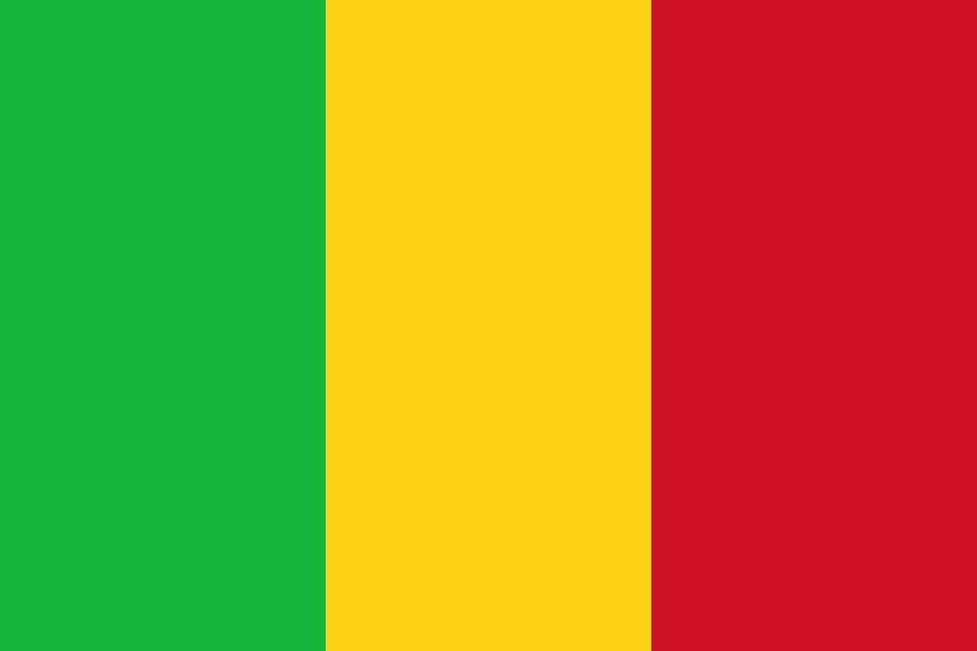


Mali: The Saharan Giant That Once Housed History’s Richest Emperor
Mali ranks as the twentieth-largest country in the world with a territory of 1,240,192 square kilometers (478,841 square miles). This immense West African nation is the continent’s eighth-largest country, yet remains largely overlooked in global consciousness. What’s truly staggering is that Mali’s massive expanse could contain France, Spain, and Germany combined—with room to spare for several smaller European nations.
What makes Mali’s geography extraordinary is its dramatic transition from the scorching Sahara Desert in the north to the fertile Niger River valley in the south. This environmental gradient created the conditions for one of Africa’s greatest historical empires and continues to shape life in this fascinating country today. Despite its massive size, most of Mali’s population is concentrated in its southern regions along the Niger and Senegal rivers.
Located between approximately 10° and 25° North latitude, Mali experiences some distortion on standard Mercator projection maps. Its northern territories appear somewhat larger than they truly are, though less dramatically than countries at more extreme latitudes. However, even accounting for this cartographic distortion, Mali’s true size remains astonishingly vast—a landlocked giant at the heart of West Africa.
Watch Mali shrink to its actual size as we move it toward the equator. We compare it to the USA, Europe, Africa, Greenland, Brazil, Australia, Russia, India, China, etc. You can use this country size comparison interactive map here.
Mali’s True Size Will Shock You: Global Perspective
To truly grasp Mali’s dimensions, these direct comparisons with familiar countries and regions provide eye-opening context:

Mali vs. Western Europe: Mali would engulf several major European powers combined
| Comparison | Area (km²) | Size Relative to Mali |
|---|---|---|
| Mali | 1,240,192 | 1.0 |
| France, Spain, and Germany combined | ~1,184,000 | ~0.95 times Mali’s size |
| South Africa | 1,219,090 | 0.98 times Mali’s size |
| Texas and California combined (US states) | 1,099,807 | 0.89 times Mali’s size |
| Peru | 1,285,216 | 1.04 times Mali’s size |
5 Mind-Blowing Mali Size Comparisons You Never Knew
- Mali vs. United States: Mali is larger than Texas and California combined. If placed over the eastern United States, it would stretch from New York to Georgia and west past the Mississippi River.

- Mali vs. Western Europe: Mali could contain France, Spain, Germany, Portugal, and Switzerland combined.
- Mali vs. Japan: Mali is approximately 3.3 times larger than Japan, despite Japan having about nine times more people.

- Mali vs. India:

- Mali vs. Australia:

Mali’s Geographic Triple Zones: Desert, Semi-Desert, and Savanna
Mali’s territory can be divided into three distinct geographical regions:
- Saharan Zone: The northern two-thirds of Mali is dominated by the Sahara Desert, featuring vast sand seas, rocky plateaus, and isolated mountain outcrops
- Sahelian Zone: The central belt is characterized by semi-arid steppe and forms part of the Sahel, a transitional zone between the Sahara and more fertile regions to the south
- Sudanic Zone: The southernmost region receives more rainfall, supporting savanna vegetation and most of the country’s agriculture
- Elevation Range: From around 200 meters (656 feet) in the Niger River valley to 1,155 meters (3,789 feet) at the summit of Mount Hombori
- Landlocked: Mali is completely landlocked, with its closest point to an ocean being approximately 550 kilometers (340 miles) from the Atlantic
The Niger River: Mali’s Lifeline
The Niger River forms the hydrological backbone of Mali and gives life to an otherwise arid country:
- The Niger is Africa’s third-longest river, flowing for approximately 1,700 kilometers (1,056 miles) through Mali
- One of the river’s most remarkable features in Mali is the Inner Niger Delta, a vast inland delta covering about 30,000 square kilometers (11,580 square miles)—an area larger than Belgium
- The Inner Niger Delta forms a complex network of channels, lakes, and floodplains that support agriculture, fishing, and livestock herding for millions of Malians
- Major cities including Bamako (the capital), Ségou, Mopti, and Gao are located along the Niger River
- The river’s seasonal flooding cycle, with waters rising during the rainy season and receding in the dry season, creates a traditional agricultural system perfectly adapted to local conditions
The Adrar des Ifoghas: Mali’s Mountain Fortress
The Adrar des Ifoghas mountains in northeastern Mali represent one of the country’s most remote and striking landscapes:
- This rugged mountain range covers approximately 250,000 square kilometers (96,525 square miles)—an area larger than the United Kingdom
- Despite being located in one of the world’s most arid regions, the mountains capture enough moisture to support pockets of vegetation and occasional seasonal streams
- The region contains remarkable prehistoric rock art dating back thousands of years, depicting a time when the Sahara was greener
- The mountains’ complex topography of plateaus, valleys, and caves has made them a historical refuge for various groups, including the Tuareg people
- In recent decades, the area’s remoteness and difficult terrain have made it a strategic location in regional conflicts
Population Distribution: A Southern Concentration
Mali’s population distribution shows one of the world’s most dramatic demographic imbalances:
- With approximately 20 million people, Mali has a very low average population density of about 16 people per square kilometer
- This density varies dramatically by region, with the northern Saharan zone having fewer than 1 person per square kilometer while some southern areas along the Niger River exceed 100 people per square kilometer
- About 90% of Mali’s population lives in the southernmost 30% of the country, primarily along the Niger and Senegal river valleys
- Bamako, the capital and largest city with about 2.7 million inhabitants, is home to approximately 13% of the country’s population
- Mali has one of the highest population growth rates in the world at approximately 3.0% annually, with a fertility rate of about 6 children per woman
Mali’s Administrative Regions: Large as European Nations
Many of Mali’s 10 regions (administrative divisions) are comparable in size to entire countries:
| Malian Region | Area (km²) | Comparable Country |
|---|---|---|
| Kidal | 151,430 | Nepal (147,181 km²) |
| Gao | 170,572 | Syrian Arab Republic (185,180 km²) |
| Tombouctou (Timbuktu) | 497,926 | Spain (505,992 km²) |
| Kayes | 120,760 | North Korea (120,538 km²) |
| Mopti | 79,017 | Czech Republic (78,865 km²) |
Geography and Climate: A Dramatic North-South Gradient
Mali’s geography creates one of the world’s most extreme climate gradients:
- Annual rainfall ranges from less than 50 mm (2 inches) in the far north to over 1,400 mm (55 inches) in the extreme southwest—a remarkable transition over the country’s north-south span
- Temperature extremes are equally dramatic, with northern areas regularly experiencing daytime highs above 45°C (113°F) during the hottest months (April-June)
- The harmattan, a dry, dust-laden wind from the northeast, dominates during the dry season (October to May), occasionally creating massive dust storms
- The southwestern region experiences a distinct rainy season from June to September/October, with progressively shorter rainy seasons as one moves northward
- This climate diversity creates distinct ecological zones, from hyperarid desert to relatively lush savanna woodlands, supporting specialized plant and animal communities adapted to each environment
The Legacy of Ancient Mali: When Gold Met Desert
Mali’s geography helped create one of history’s greatest trading empires:
- The Mali Empire (c. 1230-1600 CE) was centered on the Niger River but extended across much of West Africa, controlling crucial trans-Saharan trade routes
- Mansa Musa, Mali’s most famous emperor who ruled from 1312 to 1337, is often considered the richest person in history due to Mali’s vast gold resources
- The fabled city of Timbuktu became a center of Islamic scholarship and trade, with its location at the southern edge of the Sahara making it an ideal trans-Saharan trade hub
- The empire’s wealth came from its strategic position controlling trade between the gold-producing regions to the south and the salt resources of the Sahara
- Historical sites from this era, including the Great Mosque of Djenné and numerous historic buildings in Timbuktu, represent some of Africa’s most important cultural heritage
Natural Resources: Gold and Agricultural Potential
Mali’s vast territory contains significant natural resources:
- Mali is Africa’s third-largest gold producer after South Africa and Ghana, with major mining operations primarily in the southwest
- The country contains potential deposits of other minerals including uranium, bauxite, iron ore, manganese, tin, and copper
- The Inner Niger Delta and other river valleys offer enormous agricultural potential, particularly for rice, cotton, and other crops
- Mali has significant livestock resources, with extensive cattle, sheep, and goat herding, particularly in the Sahelian region
- The country’s vast desert areas offer substantial solar energy potential, a largely untapped resource that could help address energy needs
Timbuktu: The Desert Mystery That Captivated the World
Few cities have captured the global imagination like Timbuktu, Mali’s legendary desert outpost:
- Located near the northern bend of the Niger River at the southern edge of the Sahara, Timbuktu’s strategic position made it a crucial trans-Saharan trade hub
- During its golden age in the 15th and 16th centuries, Timbuktu was one of the world’s great centers of Islamic learning, with scholars from across Africa and the Middle East
- The city’s famous Sankore Mosque and University, along with other historic mosques, were centers for the production and collection of manuscripts, with an estimated 700,000 manuscripts surviving from this period
- Timbuktu’s remote location—it remains one of the world’s most isolated cities—contributed to its mystique in European imagination, with explorers risking their lives to reach it
- Today, despite having declined from its historical importance to a town of about 55,000 people, Timbuktu remains a UNESCO World Heritage site and a powerful symbol of West African intellectual history
Geographic Challenges: Desertification and Climate Change
Mali’s geography creates significant development challenges:
- Desertification: Mali is severely affected by desertification, with the Sahara advancing southward at an estimated rate of up to 48 kilometers (30 miles) per year in some areas
- Drought: The country has experienced several catastrophic droughts since the 1970s, most notably in 1973-74 and 1984-85, with serious consequences for food security
- Landlocked Position: Mali is disadvantaged by its landlocked position, with the nearest seaport (Dakar, Senegal) being approximately 1,200 kilometers (745 miles) away
- Regional Disparities: The vast distances and poor transportation infrastructure between northern and southern Mali create major challenges for national integration
- Climate Change: Mali is particularly vulnerable to climate change, with projected increases in temperature and rainfall variability likely to exacerbate existing environmental challenges
Contemporary Geographical Challenges: Security and Development
Mali’s vast territory creates unique challenges for governance and security:
- The sheer size of Mali, combined with limited infrastructure and difficult terrain, makes it challenging for the central government to effectively control remote regions
- The Saharan north, particularly the Adrar des Ifoghas mountains, has become a refuge for various non-state armed groups in recent decades
- Traditional trade routes across the Sahara have been repurposed for various illicit trafficking activities, taking advantage of the vastness and porosity of Mali’s borders
- Despite these challenges, Mali’s extraordinary geography also represents tremendous potential—from renewable energy in the desert to agricultural development along its rivers
- Mali’s strategic position at the crossroads of North and West Africa continues to make it a pivotal country in regional geopolitics
Explore More Size Comparisons
Curious about how other major countries and continents compare in true size? Check out these related articles:
- The Astonishing Scale of Angola: Africa’s Atlantic Giant Larger Than Five United Kingdoms
- The Real Size of South Africa: The Rainbow Nation Larger Than All of Western Europe
- The Enormous Truth About Niger: Africa’s Desert Giant That Could Swallow Europe Whole
- The True Size of Africa: A Continent Far Larger Than Maps Suggest
- Complete List of Countries by True Size
Sources & Further Reading
- Institut National de la Statistique du Mali (INSTAT). (2023). Geographical and Statistical Data.
- CIA World Factbook. (2023). Mali.