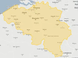
Belgium
World Rank: #136
30,528 km²
Next Larger Country
(Rank #135)
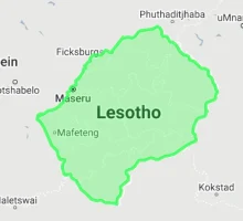
Lesotho
30,355 km²
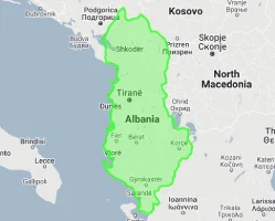
Belgium: Compact Powerhouse at Europe’s Crossroads
Belgium ranks as the 136th largest country in the world with a territory of 30,528 square kilometers (11,787 square miles). Situated at the crucial junction between Germanic and Latin Europe, Belgium is bordered by the Netherlands, Germany, Luxembourg, France, and the North Sea, occupying a pivotal position in Western Europe’s economic and political landscape.
What makes Belgium geographically remarkable is its extraordinary efficiency in using limited space. This small nation packs impressive economic, cultural, and political significance into an area roughly the size of Maryland or the combined area of Wales and Northern Ireland.
Located between latitudes 49° and 52° North, Belgium experiences some distortion on standard Mercator projection maps, though not as dramatically as countries at more extreme latitudes. The common perception of Belgium’s size is generally accurate, with its position in Europe’s heartland making it appear proportionally correct on most maps.
Let’s explore how Belgium’s true size (adjusting for Mercator projection distortion) compares to other regions and what makes this compact powerhouse geographically unique despite its modest dimensions:
Watch Belgium shrink to its actual size as we move it toward the equator. We compare it to the USA, Europe, Africa, Greenland, Brazil, Australia, Russia, India, China, etc. You can use this country size comparison interactive map here.
Belgium’s True Size in Global Perspective
To better understand Belgium’s dimensions, direct comparisons with other regions provide valuable context:

Belgium vs. US States: Belgium is similar in size to Maryland and about 1/12 the size of California
| Comparison | Flag | Area (km²) | Size Relative to Belgium |
|---|---|---|---|
| Belgium | |
30,528 | 1.0 |
| Netherlands |  |
41,850 | 1.37 times Belgium’s size |
| Switzerland |  |
41,285 | 1.35 times Belgium’s size |
| Denmark |  |
43,094 | 1.41 times Belgium’s size |
| Taiwan |  |
36,193 | 1.19 times Belgium’s size |
| Maryland (US state) |  |
32,131 | 1.05 times Belgium’s size |
| Lesotho | |
30,355 | 0.99 times Belgium’s size |
| Albania |  |
28,748 | 0.94 times Belgium’s size |
| Israel |  |
22,072 | 0.72 times Belgium’s size |
| Slovenia |  |
20,273 | 0.66 times Belgium’s size |
6 Surprising Belgium Size Comparisons
- Belgium vs. France: France is approximately 18 times larger than Belgium, meaning you could fit Belgium into France about 18 times.

- Belgium vs. Germany: Germany is about 11.7 times larger than Belgium – you could fit Belgium into Germany nearly 12 times.
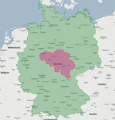
- Belgium vs. Netherlands:

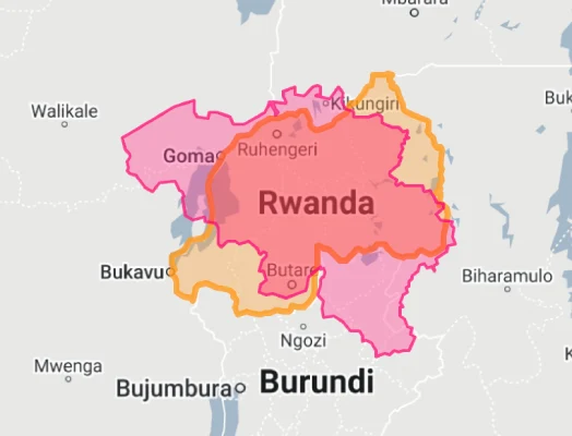
- Belgium vs. Rwanda: Belgium is about 15% larger than Rwanda, its former colony, though Rwanda has a significantly larger population.
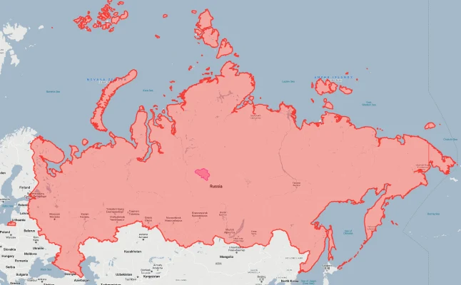
- Belgium vs. Russia: Russia is approximately 565 times larger than Belgium – the world’s largest country could fit Belgium more than 565 times within its borders.
- Belgium vs. Africa: The African continent is about 1,000 times larger than Belgium.
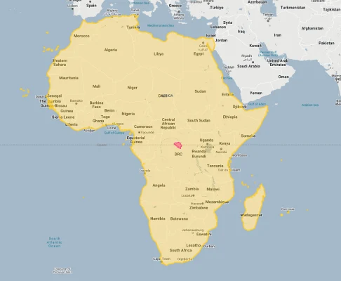
That small pink dot? That’s Belgium compared to the huge size of Africa.
Belgium’s Geographic Diversity: Three Distinct Regions
Despite its small size, Belgium contains remarkable geographic diversity:
- Coastal Lowlands: The flat coastal plain along the North Sea features polders (reclaimed land), sandy beaches, and the major port of Antwerp
- Central Plateau: The gently rolling central plateau contains most of Belgium’s major cities and agricultural lands
- Ardennes Highlands: The forested Ardennes region in the southeast features Belgium’s highest elevations, with Signal de Botrange reaching 694 meters (2,277 feet)
- Rivers: Belgium’s territory is crossed by three major rivers – the Scheldt, the Meuse, and the Yser – which have been crucial for transportation and industrial development
- Forests: Despite high population density, forests still cover about 22% of Belgium, primarily in the Ardennes region
The Linguistic Divide: Geography of Culture
Belgium’s geography has profoundly influenced its linguistic and cultural division:
- The country is divided along a roughly east-west line, with Dutch-speaking Flanders in the north and French-speaking Wallonia in the south
- Brussels, the capital, forms an officially bilingual enclave within the Flemish region
- A small German-speaking community of about 78,000 people occupies 854 km² in eastern Belgium near the German border
- This linguistic division roughly follows ancient geographic and historical boundaries between Germanic and Latin Europe
- The linguistic border became officially fixed in 1963, dividing the country into distinct administrative regions
Population Density: One of Europe’s Most Densely Populated Countries
Belgium’s compact territory supports an impressively large population:
- With approximately 11.6 million people, Belgium has an average population density of about 380 people per square kilometer, one of the highest in Europe
- Population density varies dramatically between regions, with Brussels exceeding 7,000 people per square kilometer while parts of the Ardennes have fewer than 50 people per square kilometer
- About 98% of Belgium’s population lives in urban areas, making it one of the most urbanized countries in the world
- The Brussels-Capital Region, with 1.2 million inhabitants, is the largest urban center, followed by Antwerp with about 530,000 residents
- Belgium’s extraordinary population density has necessitated sophisticated urban planning and one of Europe’s densest transportation networks
Belgium’s Administrative Divisions: A Complex Structure
Belgium’s intricate federal system divides its small territory into multiple administrative layers:
| Administrative Division | Area (km²) | Comparable Area |
|---|---|---|
| Flanders Region | 13,625 | Connecticut, USA (14,357 km²) |
| Wallonia Region | 16,844 | Kuwait (17,818 km²) |
| Brussels-Capital Region | 161 | Washington, D.C., USA (177 km²) |
| Province of Luxembourg (largest) | 4,440 | Rhode Island, USA (4,001 km²) |
| Province of Flemish Brabant | 2,106 | Mauritius (2,040 km²) |
Climate and Geography: Moderate Maritime Influence
Belgium’s position between continental Europe and the North Sea creates a distinctive climate profile:
- Belgium has a temperate maritime climate with moderate temperatures and year-round precipitation
- The coastal region experiences milder winters and cooler summers than inland areas due to North Sea influence
- The Ardennes region has a more continental climate with colder winters, more snowfall, and occasionally harsh conditions
- Average annual precipitation ranges from 700-1000mm, with slightly higher amounts in the elevated Ardennes
- Climate change is resulting in more extreme weather events, including flooding in low-lying areas and summer heat waves
Strategic Position: Crossroads of Western Europe
Belgium’s compact size belies its enormous strategic importance:
- Belgium shares 1,385 kilometers (861 miles) of borders with four countries: France, Germany, Luxembourg, and the Netherlands
- Its 66.5 kilometers of coastline on the North Sea provides crucial maritime access
- The Port of Antwerp is Europe’s second-largest seaport, handling over 235 million tons of cargo annually despite being located 80 kilometers inland
- Belgium’s central location has made it a historical battlefield, earning the nickname “the cockpit of Europe” during conflicts from the Battle of Waterloo to World Wars I and II
- Today, this strategic position has transformed Belgium into an international hub, hosting the headquarters of both the European Union and NATO
Land Use: Efficient Utilization of Limited Space
Belgium maximizes its small territory through careful land management:
- Agricultural land accounts for about 44% of Belgium’s territory, with intensive farming practices yielding high productivity
- Urban and built-up areas cover approximately 20% of the land surface, one of the highest proportions in Europe
- Forests and woodland occupy roughly 22% of Belgium, primarily concentrated in the southern Ardennes region
- Belgium has an extensive transportation network occupying about 5% of its land area, including one of the densest rail and road systems in the world
- Water bodies, including rivers, canals, and reservoirs, account for about 3% of Belgium’s surface area
Natural Resources: Limited But Strategic
Belgium’s natural resource profile reflects its geography:
- Historically, coal deposits in Wallonia fueled Belgium’s early industrialization, though the last coal mine closed in 1992
- Belgium has little in the way of metallic mineral resources, with most raw materials now imported
- Construction materials including limestone, clay, and sand remain important extractive industries
- Belgium’s most valuable natural resources today are its fertile agricultural soils and strategic location for trade
- Offshore wind in the North Sea is becoming an increasingly important energy resource, with Belgium developing one of Europe’s largest offshore wind capacity per capita
Environmental Challenges: Pressures of Density
Belgium’s compact size and high population density create specific environmental concerns:
- Water Management: Belgium faces significant challenges in managing water quality in its dense network of rivers and canals, with historical industrial pollution still affecting some waterways
- Air Quality: High population density, industrial activity, and dense transportation networks contribute to air quality challenges, particularly in urban areas
- Urban Sprawl: Limited land availability creates pressure on remaining open spaces, with ongoing challenges in balancing development needs with environmental preservation
- Flooding: Belgium’s low-lying areas face increasing flood risks due to climate change, requiring sophisticated water management systems
- Biodiversity: Habitat fragmentation due to high population density and infrastructure development poses challenges for wildlife conservation
Explore More Size Comparisons
Curious about how other major countries and continents compare in true size? Check out these related articles:
- The True Size of Switzerland
- The Real Size of France
- The Real Size of USA
- Complete List of Countries by True Size
Sources & Further Reading
- CIA World Factbook. (2024). Belgium.