Hungary
World Rank: #110
93,028 km² (35,919 sq mi)


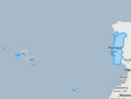
Next Smaller Country
(Rank #111)
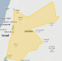
Jordan
89,342 km² (34,495 sq mi)
Hungary: The Compact Thermal Water Superpower In The Heart Of Europe
Did you know that Hungary contains more thermal water than any other country in Europe? Or that this landlocked nation sitting at the center of the continent is smaller than Indiana but contains the largest lake in Central Europe?
Welcome to the surprising dimensions of Hungary – a country whose modest size belies its extraordinary natural and cultural riches. Ranking 110th globally with just 93,028 square kilometers (35,919 square miles), Hungary is almost exactly the same size as Portugal (92,212 km²) and just slightly larger than the U.S. state of Indiana (94,326 km²).
In this article, we’ll drag Hungary across the map to reveal how this Central European nation truly measures up against other countries. Located between 45.7°N and 48.6°N latitude, Hungary experiences minimal map distortion on standard projections, meaning its depicted size on world maps is quite accurate – a compact, roughly circular nation positioned in the Carpathian Basin and surrounded by seven different countries.
Despite its modest dimensions, Hungary packs extraordinary geographic diversity into its territory. The country contains Europe’s largest thermal lake (Lake Hévíz), over 1,500 thermal springs, the largest freshwater lake in Central Europe (Lake Balaton), and extensive plains that create one of the continent’s great agricultural breadbaskets. What’s particularly remarkable is that 80% of Hungary’s territory sits less than 200 meters above sea level, creating a predominantly flat landscape dotted with modest hills rather than mountains.
Here is how big Hungary actually is (video made with our interactive tool that adjusts for Mercator projection distortion):
Watch how Hungary compares when overlaid on other countries. We’ve moved it across the USA, Western Europe, Australia, and many other nations to reveal its true proportions. You can use this country size comparison interactive map here.
7 Surprising Hungary Size Facts
- Hungary is slightly smaller than Indiana (93,028 km² vs. 94,326 km²)
- Despite its small size, Hungary contains 1,500+ thermal springs – the highest concentration in Europe
- Hungary is just 38% the size of the United Kingdom but has Central Europe’s largest lake
- The country is smaller than South Korea yet produces 65% of Europe’s foie gras
- Hungary is approximately 1/10th the size of Texas but has more medicinal spas than any European country
- The country has over 400 bird species in a territory smaller than Maine
- Hungary is so compact that its furthest points are only 528 km (328 mi) apart, meaning you can drive across the entire country in under 5 hours
Hungary’s True Size in Global Perspective
To appreciate Hungary’s actual dimensions, these direct comparisons with familiar regions offer eye-opening context:

Hungary vs. United Kingdom: Hungary is approximately 38% the size of the UK (93,028 km² vs. 242,495 km²)
| Comparison | Flag | Area (km²) | Size Relative to Hungary |
|---|---|---|---|
| Hungary | |
93,028 | 1.0 |
| Indiana (US state) |  |
94,326 | 1.01 times Hungary’s size |
| Portugal |  |
92,212 | 0.99 times Hungary’s size |
| Jordan | |
89,342 | 0.96 times Hungary’s size |
| Maine (US state) | |
91,646 | 0.98 times Hungary’s size |
| South Korea |  |
100,210 | 1.08 times Hungary’s size |
| Austria |  |
83,871 | 0.90 times Hungary’s size |
5 Fascinating Hungary Size Comparisons
- Hungary vs. Indiana: Hungary (93,028 km²) and Indiana (94,326 km²) are remarkably similar in size with just a 1.4% difference. Both are landlocked, predominantly flat territories with significant agricultural output. This comparison helps Americans grasp Hungary’s dimensions – it’s essentially a European nation the size of a single Midwestern state.

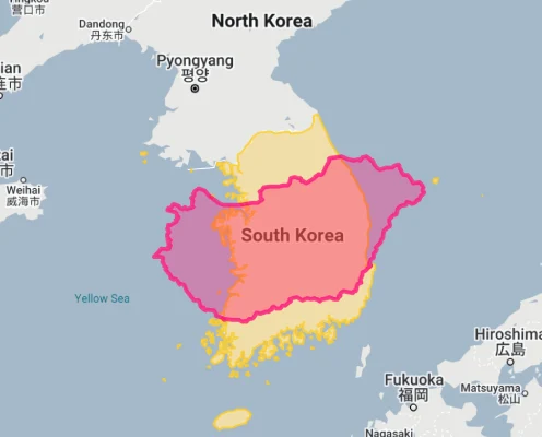
- Hungary vs. South Korea: South Korea (100,210 km²) is only about 8% larger than Hungary, yet packs five times Hungary’s population into this similar-sized territory. This creates dramatically different population densities (South Korea: 527 people/km² vs. Hungary: 105 people/km²), highlighting how countries of comparable dimensions can have vastly different human geographies.
- Hungary vs. United Kingdom: Hungary is just 38% the size of the United Kingdom (242,495 km²), visually demonstrating how compact Hungary is compared to Western Europe’s major powers. Despite this size difference, Hungary’s more centralized, less elongated shape means that no point in Hungary is more than 267 kilometers (166 miles) from the center of the country – creating more efficient internal connectivity than the UK’s extended island geography.
- Hungary vs. Texas: Hungary would fit into Texas (695,662 km²) more than 7 times, highlighting how modest Hungary’s dimensions are in comparison to large U.S. states. This size difference is particularly striking given Hungary’s historical significance as a major European power – the Hungarian portion of the Austro-Hungarian Empire once controlled territory many times larger than modern Hungary’s borders.

- Hungary vs. Neighboring Countries: Hungary is approximately 39% the size of Romania (238,397 km²), 30% the size of Poland (312,696 km²), and 84% the size of Austria (83,871 km²). These comparisons with immediate neighbors help contextualize Hungary’s place in Central Europe – a middle-small nation that’s larger than Austria and Slovakia but considerably smaller than Ukraine and Romania.

Austria overlaid on Hungary. 
Hungary overlaid on Romania. 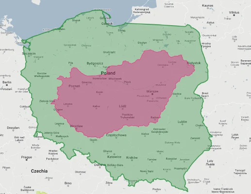
Hungary overlaid on Poland.
Hungary’s Distinctive Geography: The Carpathian Basin Heartland
Hungary’s location gives it geographical uniqueness despite its modest size:
The Perfect Basin
Hungary occupies the central portion of the Carpathian Basin – a remarkably well-defined geographical unit encircled by mountain ranges (the Carpathians, Alps, and Dinaric Alps). This creates one of Europe’s most distinctive topographic features: a nearly perfect circular plain surrounded by mountains on all sides. While the entire Carpathian Basin covers about 300,000 km², Hungary occupies its central 93,028 km², creating a country with exceptionally clear natural boundaries despite modern political borders cutting across this geographical unit.
The Continental Crossroads
Hungary sits at a crucial continental crossroads where Central, Eastern, and Southern European influences converge. Located at the meeting point of Germanic, Slavic, and Romance cultural spheres, Hungary functions as a transitional zone between these major European cultural regions. This crossroads position has historically made Hungary a crucial junction between Western Europe and the Balkans, as well as between the Baltic and Mediterranean regions, with vital trade routes crossing its compact territory.
The Hydrological Hub
Despite its modest size, Hungary contains a remarkable hydrological system, with approximately 96% of its surface waters originating from beyond its borders. The Danube River – Europe’s second-longest – flows through Hungary for 417 kilometers, collecting waters from a vast catchment area before continuing southward. Hungary contains portions of three major European drainage basins (Black Sea, Adriatic Sea, and North Sea), creating exceptional hydrological connectivity for a country of its dimensions.
The Thermal Water Wonder
Hungary sits atop one of Europe’s thinnest sections of Earth’s crust (just 24-26 kilometers compared to the continental average of 30-35 kilometers), creating exceptional geothermal activity. This unique geological position gives Hungary the highest concentration of thermal springs in Europe, with over 1,500 identified springs and 270 varieties of certified mineral waters within its modest borders. Budapest alone contains 123 natural thermal springs – more than any other capital city in the world.
Hungary’s Physical Features: Subtle But Significant Diversity
Hungary packs surprising landscape diversity into its modest territory:
- Predominantly Lowland Character: Hungary is remarkably flat, with approximately 80% of its territory lying below 200 meters (656 feet) above sea level. The Great Hungarian Plain (Alföld) in the east covers nearly half the country with elevations rarely exceeding 100 meters (328 feet). This creates a country with an unusual topographic profile – the average elevation is just 143 meters (469 feet) above sea level, making Hungary one of Europe’s flattest countries. Despite this predominant flatness, Hungary’s highest point, Kékes in the Mátra Mountains, reaches a modest 1,014 meters (3,327 feet).
- Europe’s “Inland Sea”: Hungary contains Lake Balaton – the largest lake in Central Europe and the largest shallow lake in Europe at 592 square kilometers (229 square miles). This impressive body of water stretches 77 kilometers (48 miles) in length yet maintains an average depth of just 3.3 meters (10.8 feet), creating a massive yet shallow inland “sea” that dominates western Hungary’s landscape. Remarkably, this single lake occupies nearly 0.6% of Hungary’s entire territory – a substantial water feature for a landlocked country of Hungary’s modest dimensions.
- Thermal Water Abundance: Hungary contains an extraordinary concentration of thermal waters, with over 1,500 thermal springs producing water above 30°C (86°F). The country’s modest territory includes approximately 270 different varieties of certified mineral waters and 98 recognized medicinal waters. Most remarkably, Hungary contains Europe’s largest thermal lake – Lake Hévíz (47,500 square meters) – which maintains a year-round temperature of 22-38°C (72-100°F) and completely replenishes itself every 3.5 days, creating the world’s largest naturally flowing thermal lake.
- River Networks: Despite being landlocked, Hungary contains over 9,800 kilometers of permanent and seasonal watercourses, creating a river density of 0.11 km of river per square kilometer of territory. The Danube (417 km in Hungary) and Tisza (597 km in Hungary) dominate this hydrological system, with the Tisza collecting waters from the eastern half of the country while the Danube drains the western regions. This extensive river network historically created substantial seasonal flooding across up to 25% of Hungary’s territory before 19th-century flood control projects.
- Distinctive Soil Patterns: Hungary’s modest territory contains remarkable soil diversity, with over 40 different soil types identified. Particularly significant are the Puszta grasslands of the Great Hungarian Plain, characterized by high-quality chernozem (black earth) soils that rank among Europe’s most fertile agricultural lands. This exceptional soil quality helps explain how a country occupying just 0.06% of the world’s land area has historically produced agricultural output vastly exceeding what its modest dimensions would suggest.
Hungary’s Regions: Administrative Geography
Hungary is divided into 19 counties (megyék) plus the capital Budapest:
| Hungarian Region | Area (km²) | Comparable To | Major City |
|---|---|---|---|
| Bács-Kiskun (largest county) |
8,445 | Slightly smaller than Cyprus (9,251 km²) | Kecskemét |
| Pest (surrounding Budapest) |
6,391 | Similar to Delaware (6,446 km²) | Budapest |
| Hajdú-Bihar (eastern county) |
6,211 | Similar to Delaware (6,446 km²) | Debrecen |
| Zala (southwestern county) |
3,784 | Similar to Rhode Island (4,001 km²) | Zalaegerszeg |
| Budapest (capital city) |
525 | Similar to Andorra (468 km²) | Budapest |
| Komárom-Esztergom (smallest county) |
2,265 | Smaller than Luxembourg (2,586 km²) | Tatabánya |
| Balaton Region (tourism district) |
~8,500 | Similar to Cyprus (9,251 km²) | Siófok |
Population Distribution: Medium Density With Capital Concentration
Hungary’s 9.7 million inhabitants are distributed across its compact territory with notable patterns:
- With approximately 9.7 million residents across 93,028 square kilometers, Hungary maintains a moderate population density of 105 people per square kilometer (272 per square mile) – slightly higher than the European average of 101/km² but considerably lower than neighboring countries like Austria (109/km²), Slovakia (114/km²), and particularly the Czech Republic (137/km²).
- Hungary shows significant population concentration in its capital, with Budapest and its immediate surroundings containing approximately 2.5 million people – around 25% of the entire country’s population within just 7.4% of its territory. This creates a classic primate city pattern, with Budapest approximately 9 times larger than Hungary’s second-largest city, Debrecen (approximately 202,000 residents).
- Population distribution follows distinctive geographic patterns, with higher densities in central Hungary around Budapest, the northern industrial belt, and the more fertile western regions. Lower population densities characterize the Great Hungarian Plain (Alföld) in the east, despite this region comprising nearly half of Hungary’s territory. This creates an uneven population distribution where western Hungary has population densities approximately 150% higher than eastern Hungary despite less favorable topography.
- Hungary’s settlement pattern is characterized by a relatively small number of major urban centers but a dense network of small towns and villages. The country contains just 8 cities with populations exceeding 100,000, but approximately 3,155 distinct settlements overall – creating an average of 34 settlements per 1,000 square kilometers, one of the highest such ratios in Europe. This dense settlement pattern contrasts with the sparse urban network, reflecting Hungary’s historical development as an agricultural society with limited urbanization.
- Like many Central European nations, Hungary has experienced significant population decline since 1980, losing approximately 1 million people (9.5% of its population) through a combination of low birth rates and emigration. This decline has not occurred evenly across the country, with some rural counties in eastern Hungary losing up to 15% of their population while the Budapest metropolitan area has largely maintained its population levels, creating increased regional demographic disparities within Hungary’s already modest territorial dimensions.
Unique Water Wealth: Subterranean Treasure
Hungary’s modest territory contains extraordinary water resources:
- Thermal Water Superpower: Within its compact territory, Hungary contains over 1,500 thermal springs producing water above 30°C (86°F) – the highest concentration in Europe relative to territory. This exceptional geothermal activity results from Hungary’s location in the Carpathian Basin, where the Earth’s crust is just 24-26 kilometers thick (compared to the continental average of 30-35 kilometers). Approximately 80% of Hungary’s territory contains accessible thermal water underground, with certain regions producing water as hot as 70-80°C (158-176°F) directly from natural springs.
- Medicinal Waters: Hungary’s modest land area contains 98 officially recognized medicinal waters – natural waters with proven therapeutic properties due to their unique mineral compositions. These include globally distinctive waters like those at Harkány (containing carbonyl sulfide with anti-inflammatory properties) and Hajdúszoboszló (iodide-bromide waters beneficial for rheumatic conditions). This concentration of medicinal waters gives Hungary one medicinal spring per 949 square kilometers – likely the highest such density globally.
- Subterranean Reservoirs: Hungary sits atop an estimated 70 billion cubic meters of quality thermal water – an extraordinary volume for a country of its size. The country has approximately 1,300 thermal wells tapping into this resource, with Budapest alone containing 123 natural thermal springs and 23 public bath houses – more than any other capital city. This creates a situation where approximately 80 million cubic meters of thermal water bubble to Hungary’s surface annually without pumping – enough to fill 32,000 Olympic swimming pools.
- Lake Balaton’s Significance: Hungary contains Central Europe’s largest lake with Lake Balaton – a 592 square kilometer (229 square mile) body of water that has created a distinctive regional climate and ecosystem. This massive yet shallow lake (average depth 3.3 meters/10.8 feet) holds approximately 2 billion cubic meters of water and features distinctive silky, limestone-rich water with healing properties due to its high mineral content. Remarkably, this single lake occupies nearly 0.6% of Hungary’s entire territory.
- Drinking Water Resources: Despite its modest size and landlocked position, Hungary possesses abundant high-quality groundwater resources, with approximately 95% of the country’s drinking water coming from subterranean aquifers rather than surface waters. The country’s distinctive karst landscapes have created exceptional filtering systems, resulting in naturally purified water requiring minimal treatment. Hungary’s Aggtelek and Bükk mountains contain some of Europe’s purest natural drinking water sources.
Agricultural Richness: The Pannonian Breadbasket
Hungary’s compact geography creates distinctive agricultural advantages:
- Exceptional Arable Percentage: Approximately 58% of Hungary’s territory (about 54,000 square kilometers) consists of arable land – one of the highest percentages in Europe and well above the EU average of 25%. This exceptional agricultural base means that despite occupying just 0.06% of the world’s land area, Hungary contains approximately 0.25% of the world’s arable land – a 4x overrepresentation that has historically made this small country an agricultural powerhouse.
- Soil Quality Advantage: Hungary’s compact territory contains some of Europe’s most productive soils, particularly in the Great Hungarian Plain (Alföld) which features extensive chernozem (black earth) soils with exceptional fertility. These soils, combined with Hungary’s moderate continental climate, create ideal growing conditions for cereals, particularly wheat, corn, and barley. Hungary’s agricultural productivity per hectare for major cereal crops typically exceeds the European average by 15-20% despite lower chemical inputs.
- Distinctive Specialty Production: Despite its modest dimensions, Hungary dominates several specialized agricultural niches. The country produces approximately 65% of Europe’s foie gras, ranks as the world’s largest producer of high-oleic sunflower seeds, and is Europe’s second-largest producer of honey per capita after Greece. Hungary also maintains one of the highest concentrations of paprika cultivation globally, with the Kalocsa and Szeged regions producing distinctive high-quality paprika strains protected by European geographical indications.
- Viticultural Heritage: Hungary contains 22 wine regions within its limited territory, including the Tokaj region – the world’s first formally delimited wine appellation (established in 1737, preceding Bordeaux by decades). Despite occupying just 93,028 square kilometers, Hungary produces approximately 2.5 million hectoliters of wine annually from 64,000 hectares of vineyards, with a remarkable diversity of 155 indigenous grape varieties – one of the highest concentrations of native vine genetics in Europe.
- Climate and Microclimate Advantages: Hungary’s position in the Carpathian Basin creates a distinctive continental climate with Mediterranean influences, resulting in long growing seasons averaging 175-190 frost-free days annually. The country’s modest size combined with varied topography creates numerous distinctive microclimates, including the Lake Balaton region where water moderation effects extend growing seasons by 15-20 days compared to surrounding areas. These favorable climate conditions allow Hungary to grow crops ranging from winter wheat to watermelons within its limited territory.
Border Complexity: The Multi-Neighbor Nation
Hungary’s boundaries create distinctive international relationships:
- Hungary shares a 2,185-kilometer (1,358-mile) land border with seven countries: Austria (366 km), Slovakia (676 km), Ukraine (103 km), Romania (424 km), Serbia (164 km), Croatia (329 km), and Slovenia (102 km). This creates the most internationally connected country in the Carpathian Basin, with Hungary bordering more nations than any other country in the region. This exceptional connectivity gives Hungary 23.5 meters of international border per square kilometer of territory – among the highest such ratios in Europe.
- Despite having seven neighbors, Hungary’s borders are remarkably stable, having remained essentially unchanged since the Treaty of Trianon in 1920 (with minor adjustments during World War II temporarily reversed afterward). This century of border stability represents a significant achievement in a region historically characterized by frequent territorial changes. However, this stability followed the treaty that reduced Hungary’s territory by approximately 72% – one of the most dramatic territorial reductions of any European nation in modern history.
- Hungary’s compact dimensions and multiple neighbors create the situation where the average distance from any point in Hungary to an international border is just 65 kilometers (40 miles) – among the lowest such measurements in Europe for a nation of Hungary’s size. The maximum distance to an international border from any point in Hungary is just 134 kilometers (83 miles), creating a country where international boundaries are always relatively nearby.
- Hungary’s position as a member of the Schengen Area while bordering four non-Schengen countries (Ukraine, Romania, Serbia, and Croatia) creates a complex border management situation. Approximately 1,022 kilometers of Hungary’s borders (47% of total) form part of the Schengen Area’s external frontier, creating significant border security responsibilities for a country with Hungary’s modest dimensions.
- Despite the Treaty of Trianon’s dramatic reduction of Hungarian territory, significant Hungarian ethnic populations remain in neighboring countries, particularly Romania (1.2 million), Slovakia (450,000), Serbia (250,000), and Ukraine (150,000). This creates a situation where the Hungarian cultural and linguistic sphere extends well beyond the country’s political boundaries, with approximately 2.2 million ethnic Hungarians living in adjacent countries – equivalent to 22% of Hungary’s current population.
Historical Geographic Transformation: From Empire to Small State
Hungary’s territorial evolution creates a distinctive historical geography:
- Dramatic Territorial Reduction: Prior to World War I, the Kingdom of Hungary within the Austro-Hungarian Empire covered approximately 325,411 square kilometers (125,642 square miles) – nearly 3.5 times larger than modern Hungary’s 93,028 square kilometers. The 1920 Treaty of Trianon reduced Hungary’s territory by approximately 72%, creating one of history’s most dramatic peaceful territorial contractions. This reduction transformed Hungary from a multi-ethnic, multi-regional power into a predominantly ethnically homogeneous small state.
- Population Transformation: The Treaty of Trianon not only reduced Hungary’s territory but also separated approximately 3.3 million ethnic Hungarians from their motherland – a figure equivalent to about one-third of Hungary’s post-treaty population. This created a situation where a significant portion of the Hungarian nation suddenly became minority populations in newly formed or enlarged neighboring states, generating ethnic tensions that continue to influence regional relationships a century later.
- Geographic Core Preservation: While Hungary lost 72% of its pre-World War I territory, the Treaty of Trianon largely preserved the geographical core of the Hungarian state – the central Carpathian Basin and the Great Hungarian Plain. This allowed Hungary to retain its most productive agricultural lands and its historical capital, facilitating economic recovery despite the dramatic territorial losses. The post-Trianon boundaries also followed natural features more closely than the historical Kingdom’s borders had, creating more defensible frontiers.
- Regional Connectivity Disruption: Hungary’s territorial contraction severed traditional economic connections, with newly established borders cutting across previously integrated regions, transportation networks, and economic systems. Prior to 1920, Budapest had functioned as the economic and transportation hub for a much larger territory; afterward, many rail lines and roads led to settlements now in different countries. This disruption created particular challenges for Hungary’s reduced territory, which suddenly lacked natural resources previously available within its borders.
- Psychological Impact: The dramatic territorial reduction created a persistent national trauma that continues to influence Hungarian collective identity and politics. The loss of approximately two-thirds of the country’s territory generated a distinctive national narrative focused on historical injustice and territorial loss, influencing Hungary’s twentieth-century development and still affecting its relationships with neighboring countries. This psychological dimension adds complexity to Hungary’s modern geography, creating perceptions of territorial inadequacy despite Hungary’s current borders closely matching its primary ethnic distribution.
Explore More Size Comparisons
Curious about how other major countries and regions compare in true size? Check out these related articles:
- Real Size Of Austria: Alpine Nation Smaller Than Maine But With World’s Largest Underground Lake
- Real Size Of Czech Republic: The Most Castles Per Square Kilometer In Europe
- Real Size Of Romania: Almost Identical To UK But With Just 1/3 The Population
- Real Size Of Slovakia: Tiny Nation With Europe’s Highest Density Of Caves
- Complete List of Countries by True Size
Sources & Further Reading
- Hungarian Central Statistical Office. (2024). Geographical Information and National Statistics.
- Ministry of Agriculture. (2024). Hungarian Environmental and Agricultural Data.
- CIA World Factbook. (2024). Hungary.